
DO YOU LIVE IN WILDWOOD, POINT ROAD, OR CRESCENT PARK COMMUNITIES?
We are looking for your input on the conditions for active transportation in your neighbourhood. Please read below to learn about this project and ways to share your perspective!
Phase 1 – Report Completed
Thank you for helping us with the first phase of the project! With your feedback by survey and at our public meetings, we were able to put together the report below. The report identifies local stakeholders, as well as key issues and opportunities for active transportation in the East Fort Garry community. It is expected that the next phase of this project, a broader scale community engagement will take place over the next year (2015-2016).
Neighbourhood Scan Final Report – East Fort Garry – Click here for report!
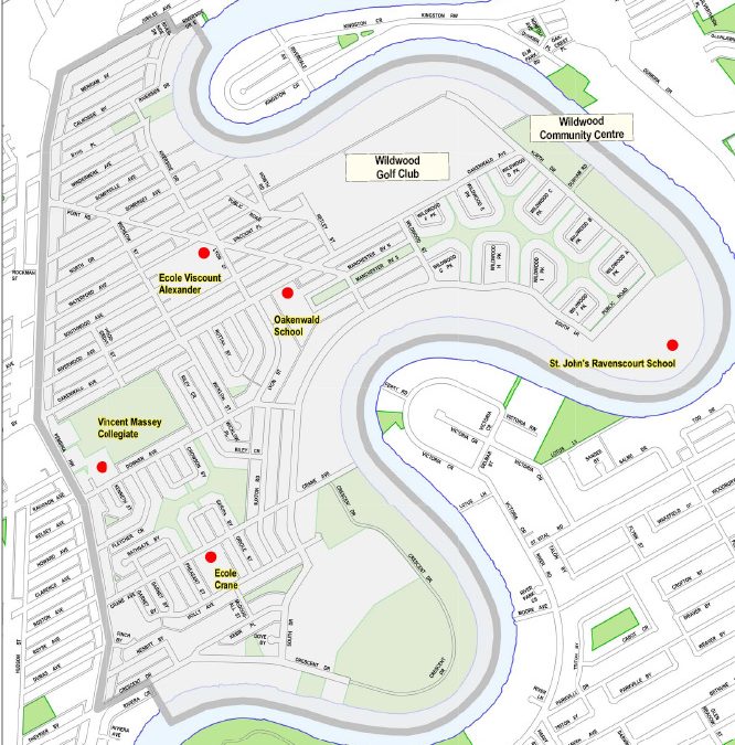
Project Scope & Boundary
This project is an evolution of work that began with neighbourhood elementary schools, and is now expanding to the broader community. Funded by the City of Winnipeg, it is the first step of a neighbourhood-level engagement strategy around active transportation.
At this stage, we have identified local stakeholders, as well as key issues and opportunities for active travel in the East Fort Garry community.
The defined boundary for this project is shown on the map below, and is described as the area between the Red River/Riverside Drive (east) and Pembina Highway (west), Jubilee to the north and Crescent Drive to the south.


Recent Comments